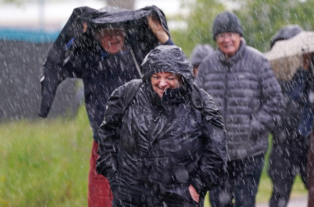
London faced downpours yesterday,and the wetness will last into the weekend (Picture: PA)
This week has been miserable across the UK – rain showers in London,winds near the coast and lower temperatures.
Today,a Yellow National Severe Weather Warning came into effect at 9 am,covering parts of central and southern England and Wales.
Met Office Chief Meteorologist Dan Suri said: ‘Frequent heavy showers and thunderstorms are expected for much of Saturday,before they fade from the west during the mid-to-late afternoon.’
Don’t fret – it won’t be long until we can start experiencing some warm,summery weather again.
Earlier this week,rain and thunder hit London as temperatures dipped lower than usual at 17C.
The rainy and windy weather will last through the weekend,with the Met Office warning that the storms will be ‘heavier and more frequent’,with hail even possible.
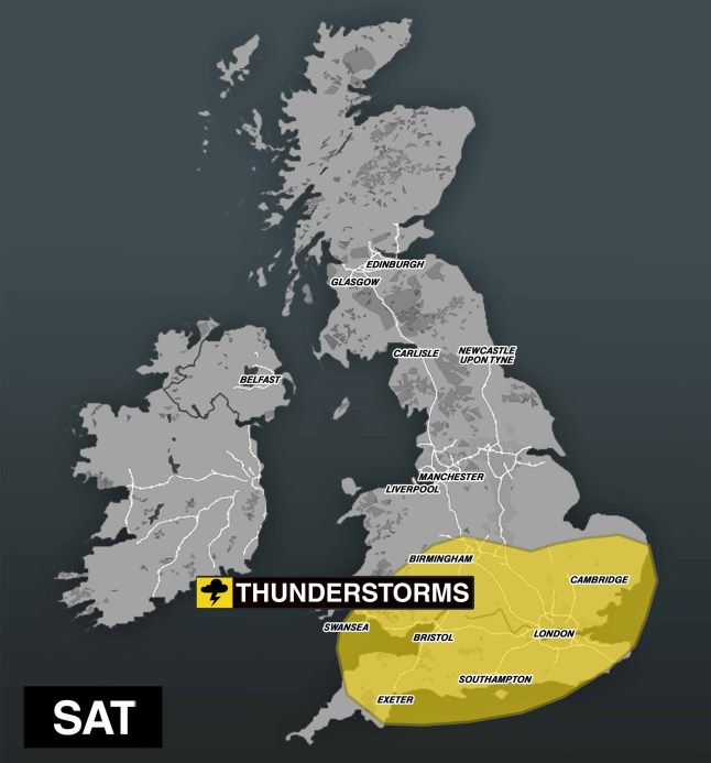
Thunderstorm warnings are over much of England and Wales (Picture: Metro)
Dan added: ”A yellow warning for thunderstorms has been issued and covers parts of central and southern England and Wales.
‘While brisk winds ensure that most places in the warning area will be hit by showers,not all places will see thunderstorms.
‘In this case it’s difficult to predict where exactly thunderstorms will hit because they are small and fast changing.’
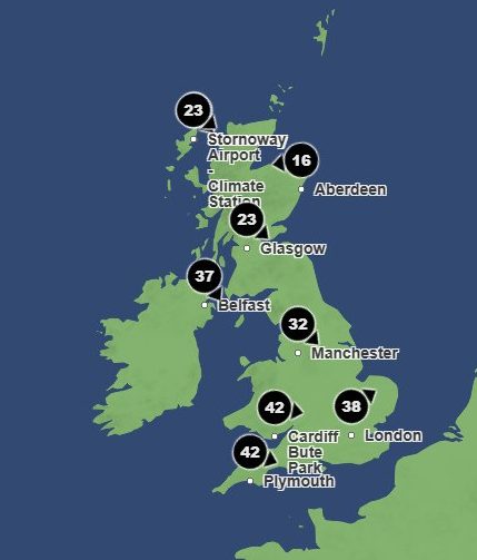
Saturday will be quite blustery (Picture: Met Office)
To get the latest news from the capital visit Metro's London news hub.
On Friday,there will be early rain in the south,some sunshine and showers in the north,with the weather only set to get wetter the following day.
On Saturday,Southport and other areas in the south of England could see gusts of up to 40mph,according to Met Office predictions.
Met Office spokeswoman Andrea Bishop pointed out that the blustery weather isn’t gone yet,adding: ‘We are keeping an eye on a new front which looks like it will move in on Friday night,bringing rain which could be heavy,and possibly thundery at times on Saturday.
‘Rainfall totals of 20mm to 30mm are likely in places,and,at present,this looks like it will affect the southern half of the UK. We are keeping a close eye on this to see how it evolves over the next 24 hours or so.’
Saturday will see rain across the UK,but conditions will dry up by Sunday across the south of the country.
The Met Office said: ‘The weather will be changeable for the rest of this week,with everyone likely to see some showers at some point
‘We are keeping an eye on a new front which looks like it will move in on Friday night,and possibly thundery at times on Saturday.’
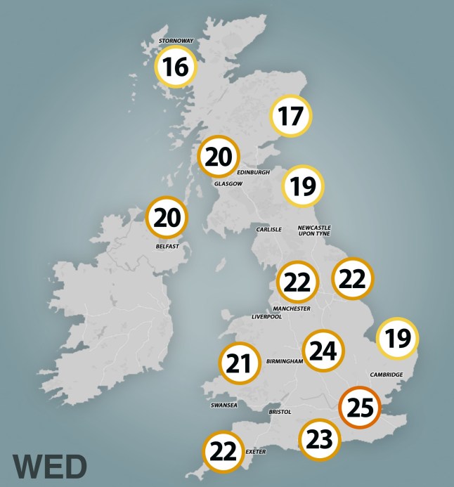
By Wednesday,temperatures will rise to 25C in some areas (Picture: Metro)
Monday is set to see more rain,with a cool breeze expected to keep temperatures below average.
Tuesday will see warmer weather creep in,and by the middle of next week,temperatures are expected to be higher than average,signalling the start of warm summer weather.
Luckily,temperatures will rise to 25C by Wednesday,accompanied by a bit of sun to dry out the rain.
United News - unews.co.za