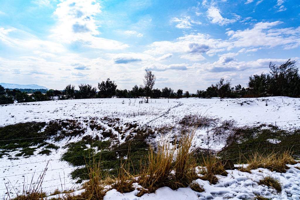
According to the weather service,snowfall can be expected over high-lying areas and mountain peaks,leading to icy road conditions,especially in the Beaufort West Municipality.
Alfonso Nqunjana/News24
The South African Weather Service (SAWS) has warned of damaging winds,cold,light rain and snow in parts of the Eastern Cape and Western Cape.
In the SAWS colour-coded weather warning system,yellow indicates a moderate risk of impact that requires caution and awareness,while orange indicates that higher-risk impact is expected,requiring increased attention and preparation.
SAWS uses the numbers to indicate the likelihood of weather-based impacts occurring. Levels 2 and 6 are high,and Level 4 is low.
ADVERTISEMENT
WHAT IS AN IMPACT-BASED WEATHER WARNING?
How often do you come across news reports suggesting that the South African Weather Service (SAWS) has issued an Impact-Based Weather Warning of a certain level and a particular colour-coding? What does it mean?
🧵 pic.twitter.com/pbogTnKxkl
— SA Weather Service (@SAWeatherServic) June 5,2025
Snowfall may occur over high-lying areas and mountain peaks in the Western Cape and Eastern Cape. This could lead to icy road conditions,particularly around Beaufort West Municipality in the Western Cape.
ADVERTISEMENT
MEDIA RELEASE: A spell of extreme winter weather starting this weekend,with snowfalls possible over all provinces,except Limpopo pic.twitter.com/FlHRWp3rLY
— SA Weather Service (@SAWeatherServic) June 5,2025
Mpumalanga: Partly cloudy at first; otherwise,fine and cool to warm but cold in some areas.
Limpopo: Partly cloudy and cool to warm,clearing in the evening.
North West: Fine in the east initially,then becoming partly cloudy,windy and cool.
Free State: Partly cloudy,windy and cold to cool,with isolated showers and thundershowers expected in central and western areas.
Northern Cape: Fine and windy over the central region,turning partly cloudy with isolated showers and thundershowers in the east. Evening fog patches likely along the coastline. Temperatures will range from cold to warm. Coastal winds: Light and variable.
Western Cape: Fine and cool,turning partly cloudy in the west. Cloud cover will increase in the southwest,with light rain expected from the evening. Coastal winds: Light to moderate westerly to northwesterly,strengthening along the southwest coast by evening.
Western half of the Eastern Cape: Fog patches in southern regions,otherwise fine and cool. Coastal winds: Light to moderate westerly,shifting to north-easterly in the evening.
Eastern half of the Eastern Cape: Fine and cool,turning partly cloudy with isolated showers and thundershowers in the north. Warmer conditions likely south of the escarpment. Coastal winds: Moderate to fresh south-westerly.
KwaZulu-Natal: Fine and warm,but cooler in the southwest. Coastal winds: moderate to fresh northerly to north-easterly.
The SAWS did not provide temperatures at the time of publishing. They will be updated once available.
*This weather report was written with the support of Toqan AI.
United News - unews.co.za